blog • October 15, 2026
QUESTION
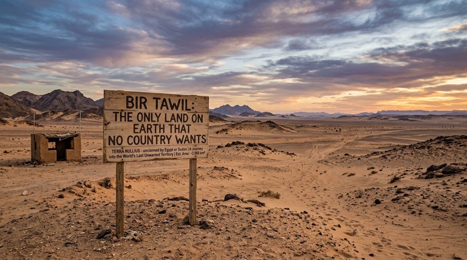
Bir Tawil: The Only Land on Earth That No Country Wants
VERIFIED ANSWER
Countries have fought wars over rocky islands, frozen glaciers and tiny strips of riverbank. Yet in the eastern Sahara there is a stretch of desert roughly the size of a large city that nobody is fighting over at all. Its name is Bir Tawil, and it is the only habitable piece of land on Earth […]
Countries have fought wars over rocky islands, frozen glaciers and tiny strips of riverbank. Yet in the eastern Sahara there is a stretch of desert roughly the size of a large city that nobody is fighting over at all. Its name is Bir Tawil, and it is the only habitable piece of land on Earth that no recognised country claims as its own.
That sounds like an open invitation to start your own nation, and plenty of people have tried. But the real story of Bir Tawil is less about free land and more about a colonial map mistake, a valuable neighbour, and a simple rule of diplomacy: sometimes the best way to keep what you want is to refuse something you are offered.
You will often see it called the “Bir Tawil Triangle”, but that nickname is misleading. The territory has four sides, not three. It picked up the label because it touches the much larger Hala’ib Triangle at a single corner point, and the two are usually discussed together.
What makes Bir Tawil stand out is that it is habitable dry land in Africa, not ice, and its neighbours are actively choosing not to take it.
What Is Bir Tawil? Quick Facts
Bir Tawil sits on the border between Egypt and Sudan, just south of the 22nd parallel of latitude. Here are the basics in one place:| Location | Eastern Sahara (Nubian Desert), between Egypt and Sudan |
| Area | About 2,060 km² (roughly 795 square miles) |
| Shape | A trapezoid – about 95 km wide along the north, 46 km along the south |
| Meaning of the name | “Tall (or deep) water well” in Arabic |
| Highest point | Gabal Hagar El Zarqa, around 662 m |
| Surface water | None |
| Permanent population | None officially, though nomads and gold miners pass through |
| Claimed by | No recognised state |
Why Does No Country Want Bir Tawil?
The short answer: because claiming Bir Tawil would mean giving up something far more valuable next door. To understand why, you have to go back more than a century to two different lines drawn by the British.The 1899 Line: A Straight Border on the 22nd Parallel
In 1899, Britain and Egypt agreed to rule Sudan jointly under an arrangement known as the Anglo-Egyptian Condominium. In practice Britain held most of the power. The agreement set the boundary between Egypt and Sudan along a perfectly straight line: the 22nd parallel north. Everything above it was Egypt; everything below it was Sudan.The 1902 Line: An Administrative Fix
Straight lines look tidy on paper but rarely match how people actually live. Just three years later, British officials drew a second, “administrative” boundary based on which tribes used which land:- The Bir Tawil area, south of the 22nd parallel, was used as grazing land by the Ababda people, who had closer ties to Egypt. So it was placed under Egyptian administration.
- The Hala’ib Triangle, north of the 22nd parallel on the Red Sea coast, was home to Beja groups more closely linked to Sudan. So it was placed under Sudanese administration.
The Hala’ib Triangle: The Prize Both Countries Want
This is where Bir Tawil becomes trapped. The Hala’ib Triangle is roughly ten times larger, it has a long Red Sea coastline, fishing grounds, towns and mineral potential. Bir Tawil, by comparison, is landlocked rock and sand with no water.- Egypt insists on the 1899 straight line. Under that border, Hala’ib belongs to Egypt – and Bir Tawil falls to Sudan.
- Sudan insists on the 1902 administrative line. Under that border, Hala’ib belongs to Sudan – and Bir Tawil falls to Egypt.
Who Owns Bir Tawil Today?
Legally, nobody. Bir Tawil is often described as terra nullius, a Latin phrase meaning “land belonging to no one”. Apart from parts of Antarctica (most notably Marie Byrd Land), it is the only significant patch of land on the planet that no recognised state claims. But “unclaimed” is not the same as “empty” or “unused”. That difference matters, and most quick articles about Bir Tawil skip over it.Does Anyone Live in Bir Tawil?
There are no permanent towns or official residents. However, the land is far from lifeless:- Nomadic tribes – the Ababda and Bisharin peoples have moved through this desert for centuries, grazing animals and travelling trade routes.
- Gold prospectors – the region sits in an old gold-mining belt. Visitors in recent years have described mining camps, trucks of workers and makeshift supply stalls.
- Seasonal life – dry valleys called wadis can briefly support plants after rare rains, which is likely how a “water well” gave the area its name.
People Who Tried to Claim Bir Tawil
An unclaimed patch of land is irresistible to dreamers, adventurers and publicity seekers. Several have planted flags here. None has been recognised by any country or by the United Nations.Jeremiah Heaton and the Kingdom of North Sudan (2014)
The most famous claim came from Jeremiah Heaton, a farmer from Virginia in the United States. In 2014 he travelled to the area, raised a flag designed by his children and declared the “Kingdom of North Sudan”. His reason went viral: he wanted his young daughter to become a real princess. Heaton later spoke about agricultural and solar projects for the land, but his kingdom never gained official recognition – and local tribal leaders reportedly did not appreciate a foreigner announcing himself as their ruler.Dmitry Zhikharev and the “Kingdom of Middle Earth” (2014)
Later the same year, Russian radio enthusiast Dmitry Zhikharev said he reached the territory and named it after the fantasy world of J.R.R. Tolkien. His team also ran an amateur radio broadcast from inside Bir Tawil in 2016. Zhikharev has publicly argued that some rival claimants only got close to the border rather than actually entering.Suyash Dixit and the Kingdom of Dixit (2017)
In 2017, Indian entrepreneur Suyash Dixit posted photos of himself planting a flag and declared the “Kingdom of Dixit”, naming himself ruler and inviting people to apply for citizenship online. The claim drew huge attention on social media in India – and an immediate online argument with the earlier “kings”. Beyond these three, there are many more: online “empires”, micronations with websites and anthems, and joke flags left behind by travellers. Bir Tawil has, ironically, become one of the most “claimed” unclaimed places in the world.Can You Claim Bir Tawil and Start Your Own Country?
In theory it sounds simple: the land is unclaimed, so whoever arrives first should own it. In reality, planting a flag does not create a country. Under international law, a state is generally expected to have:- A permanent population – people who actually live there.
- A defined territory – Bir Tawil does have clear edges, at least.
- A functioning government – one that truly controls the area.
- The capacity to deal with other states – which in practice means other countries must be willing to recognise you.
Can You Visit Bir Tawil?
A handful of journalists and adventurers have made the journey, but it is not a tourist trip. Here is what makes visiting Bir Tawil so difficult:- No roads: there are no paved roads, signs or official tracks – only tyre marks left by miners and traders.
- Extreme remoteness: the nearest Egyptian town with an airport, Abu Simbel, lies well over 100 km away across the desert, with Lake Nasser in the way.
- Military permissions: both the Egyptian and Sudanese border areas are sensitive. Past travellers report needing permits and local escorts, and unauthorised movement can be extremely dangerous.
- No services: no water, shops, hotels, phone signal or emergency help. Every litre of water must be carried in.
- Harsh climate: summer temperatures in this part of the Sahara regularly climb well above 40°C.
- Current security situation: Sudan has been affected by armed conflict since 2023, and many governments advise against all travel there. Always check your government’s latest travel advice.
Bir Tawil vs Other “No Man’s Lands”
Bir Tawil is unusual, but it is not the only odd border story in the world. Here is how it compares:| Place | Where | Status | Why it is unusual |
|---|---|---|---|
| Bir Tawil | Egypt–Sudan border | Claimed by no state | Both neighbours reject it to protect their claim on Hala’ib |
| Marie Byrd Land | Antarctica | Claimed by no state | Too remote and icy for any country to bother claiming |
| Hala’ib Triangle | Egypt–Sudan border | Claimed by both | The valuable “twin” that keeps Bir Tawil unclaimed |
| Gornja Siga (“Liberland”) | Croatia–Serbia, Danube river | Disputed border pocket | A self-declared micronation was announced there in 2015 |
Interesting Facts About Bir Tawil
- Bir Tawil and the Hala’ib Triangle meet at a quadripoint – a single spot where four border lines come together.
- On Google Maps the borders around it are shown as dotted lines, a sign of an unresolved dispute.
- Its northern mountain, Jabal Tawil, rises to about 459 m, while the highest peak sits in the east at around 662 m.
- It is roughly half the size of the US state of Rhode Island.
- Despite being “unclaimed”, it has been “claimed” by more private individuals than almost anywhere else on Earth.